Killetsoft
Advertisement

CONVERT v.6.07
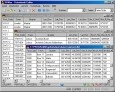
The freeware program CONVERT from KilletSoft converts databases and files between the dBase, CSV and SDF data formats and the character sets ANSI, ASCII, UTF8 and Unicode. Thus the import of the data in any DBMS will be possible.
Advertisement

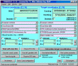
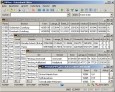
CONVERT English v.401
The freeware program CONVERT from KilletSoft converts databases and files between the dBase, CSV and SDF data formats and the character sets ANSI, ASCII, UTF8 and Unicode. Thus the import of the data in any DBMS will be possible.

CONVERT Deutsch v.4.01
The freeware program CONVERT from KilletSoft converts databases and files between the dBase, CSV and SDF data formats and the character sets ANSI, ASCII, UTF8 and Unicode. Thus the import of the data in any DBMS will be possible.
CONVERT (Deutsch) v.1 3
The freeware program CONVERT converts any dBase formatted data base tables and special the Geo Data supplied by KilletSoft GbR as dBase tables into different data formats.

CONVERT (English) v.1 3
The freeware program CONVERT converts any dBase formatted data base tables and special the Geo Data supplied by KilletSoft GbR as dBase tables into different data formats.
TRANSDAT (English)
TRANSDAT Geosoftware executes coordinate transformations and geodetic datum shifts between lots of coordinate and reference systems of Germany, Europe, America, Australia and world wide. The current and historical coordinate and reference systems
TOPOWIN v.16.00
TOPOWIN is a state-wide register of the German topographic cartographies and of localities with geo references in different coordinate systems. It also is a topographic information system.
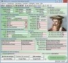
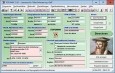
ORTWIN v.13.02
ORTWIN is a program for the inquiry of localities in Germany. It finds postal zip codes, telephone pre selections, coordinates. It performs perimeter searches and distance calculations. It finds landscapes, natural units, snow- and wind load zones.

SEVENPAR (English)
The program produces a set with seven parameters of the sapatial Helmert transformation valid for an specific area, with which then arbitrary coordinates of the area can be transformed from one reference system into another with high accuracy. The

Geodaten International Admin
Geo data international world-wide with towns, town quarters and postal codes. Georeferences as UTM- and geographic coordinates (WGS84) and elevations. Suitable for branch searches, periphery searches and distance computations. Australia, Austria,
Geodaten German Admin
The database contain geodata of the Federal Republic of Germany with geo referenced towns, municipalities, town quarters, administrative units, postal codes, telephone preselections, nature areas, landscapes, climatic zones. The data contain coordinates